Following on from my post of images from key scenes of the novel Turn of the Wheel, I have produced a similar piee for By the Banks of the Rheidol. These are the actual places that inspired parts of the plot.
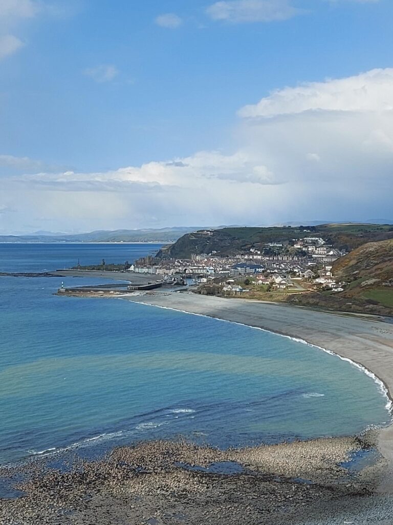
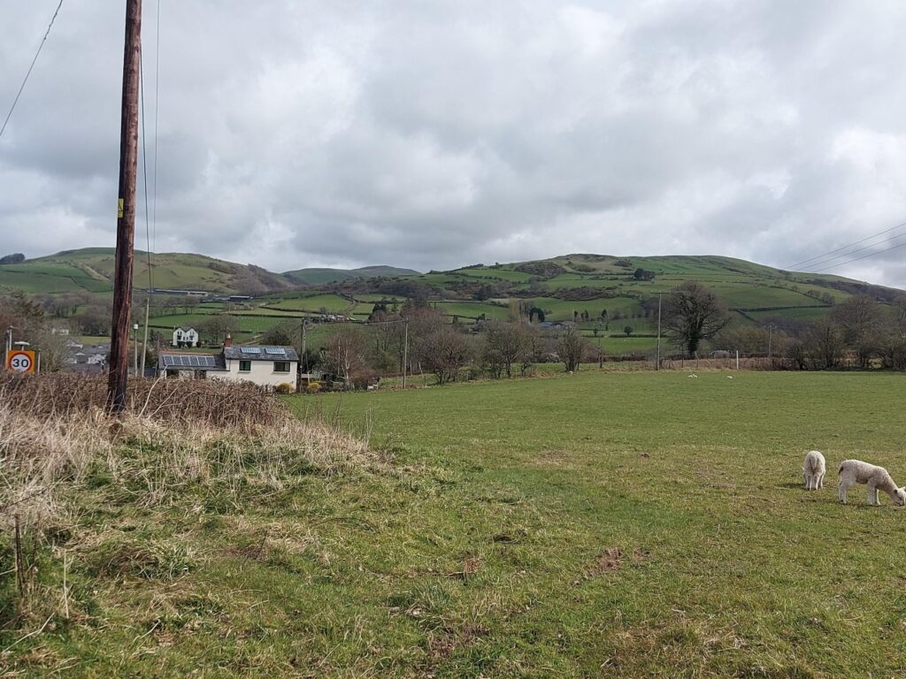
Firstly, this is Aberystwyth, as seen from the South. Tanybwlch beach is in the foreground. Pen Dinas raises to the right. The harbour entrance is behind the breakwater. Trefechan is to the right of this and Aberystwyth Town to the left.
One of Trefechan lime kilns, the masts of yachts can be seen in the harbour behnd. This is opposite the modern day fire station. Locals would use the embers of the fire to cook potatoes.
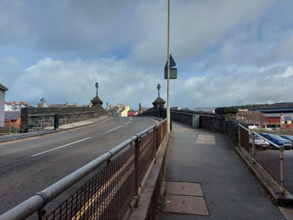
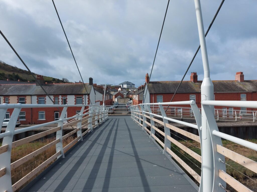
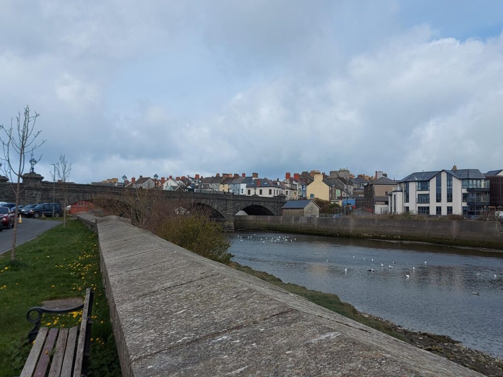
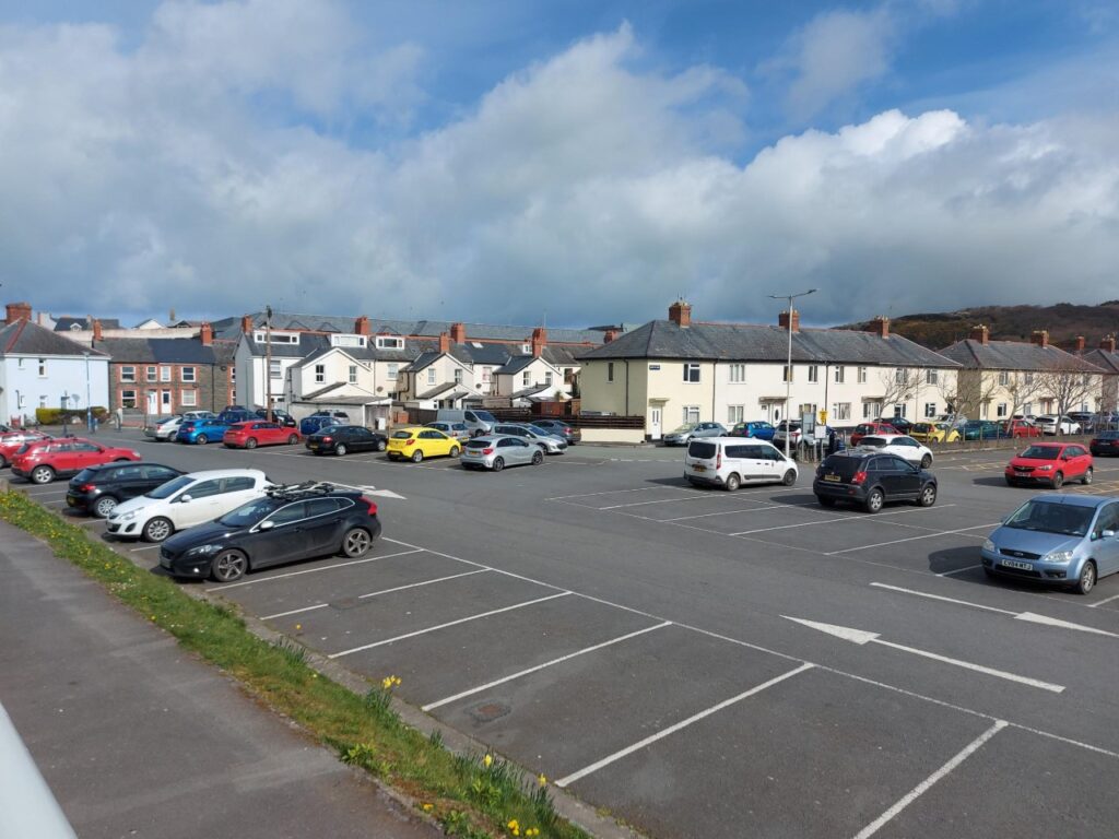
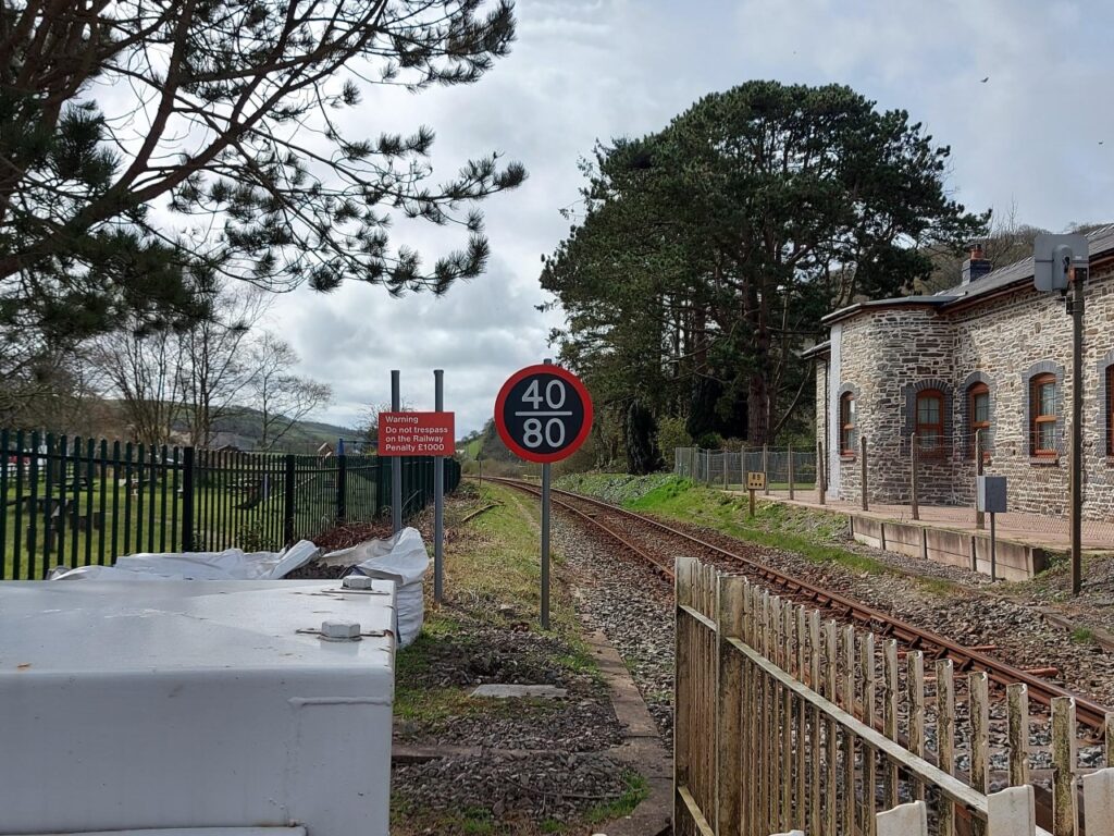
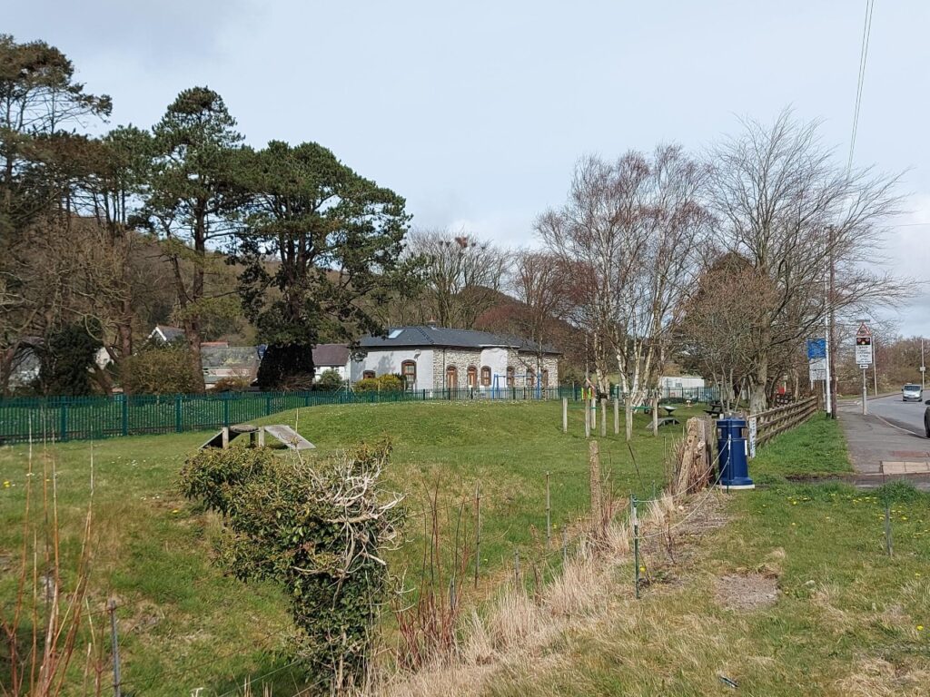
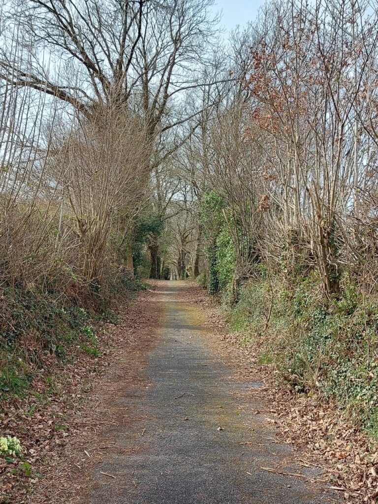
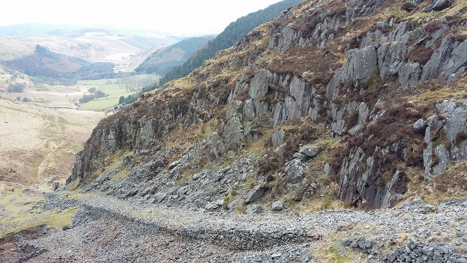
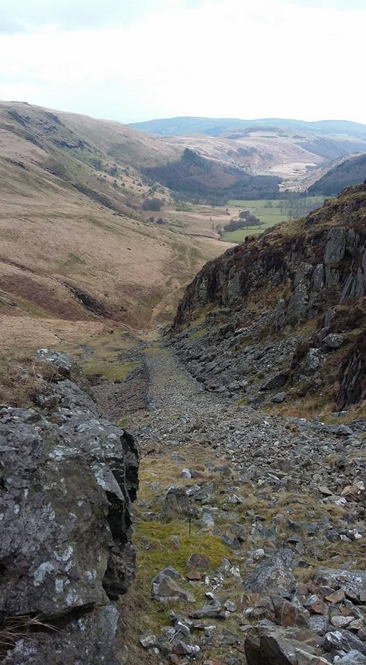
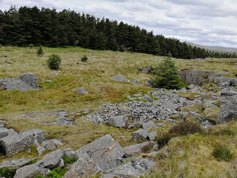
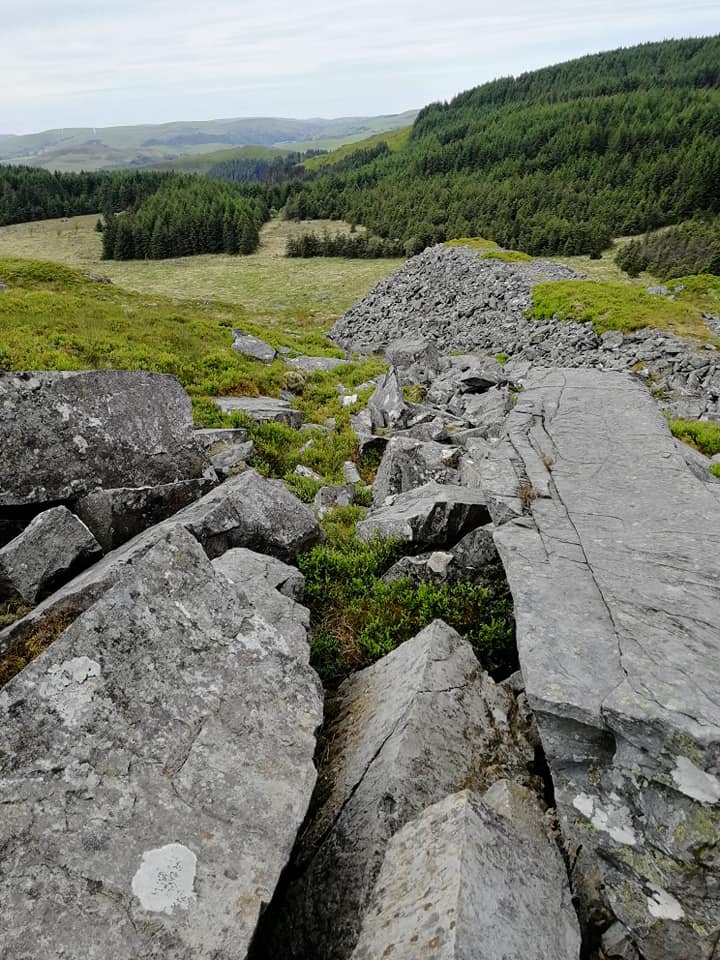
Trefechan Bridge looking north to Aberystwyth. This bridge was built in 1886 to replace one destroyed by flood.Trefechan terraced houses by the banks of the Rheidol, taken from a bridge added in 2000Looking across from Trefechan and the river Rheidol to Aberystwyth. The end arches on each side can be walked under, although on the Trefechan side, it is now impeded by flood defences. The Aberystwyth end became the route of the Vale of Rheidol railway harbour branchCar park off Park Avenue and outside the football ground. This was the site of the first Vale of Rheidol railway station. The line of houses to the right mark the line of the original station. To the left was the engine shed and harbour branch. The now-closed station at Llandre, formerly Llanfihangel Geneu’r Glyn. Looking towards Aberystwyth, the goods sidings were to the left, the fence marking the site of the old up platform.Llandre station looking towards Borth. the mound in front marks the goods platform. The road to the left goes uphill towards a junction between Borth and Talybont roads. Halfway up the hill, a wharf marked the interchange building between the main railway and the Plynlimon and Hafan Tramway.The trackbed of the Plynlimon and Hafan tramway, parallel to the main road before it drops into Talybont from the south. This part is now a cycleway.Looking across the fields, as Talybont village disappears to the left in a pronounced valley. The station for Talybont, ‘Penrhiw’, was over by the trees, where the ground is raisedThe incline at the Hafan quarry. Still solid. The Hafan mine shaft is to the left. A waterwheel is at the base of the incline, where the railway loop and sidings can be seen. The bottom of this is as far as steam engines would go.The incline from the quarry looking down towards Talybont. The top part was obliterated during the building of Nantymoch reservoir. Despite being closed 120 years ago, the line of the tramway can be seen all the way down the valley and through the woodland. The lead mine, Bwlch Glas, lies behind this. Despite being the end of an eight mile railway, the Hafan quarry appears small – or at least the upper part does. The rock formed thick slabs, with very linear cuts. The waste pile can be seen in the second picture, the amount of stone cast points to much work being done there!
By Geraint Roberts
Stuck in a limbo and desperate to do something meaningful, what to do? That is where writing began for me. A creative way of expressing myself and a chance to harness my wondering imagination. I close my eyes and I'm there. Wish I'd picked 'there' as a warm sunny day on a sandy beach, with the waves gently lapping on the shore...but I have to let the story load in my mind, then watch it unfold, wherever it may be. Currently I'm on a windy bridge, or a Devon beach, or a Cornish tin mine, or a submarine, or looking towards a Hebridean port...